For Immediate Release:
Monday, July 11, 2005

|
For Immediate Release: Monday, July 11, 2005 |
|
Contact: Christy Skeen |
|
||||
|
Phoenix College Class Allows Students to Visualize the World in a Unique Way
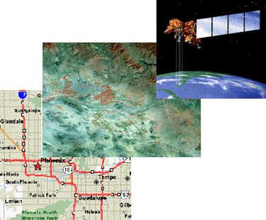
(PHOENIX, Ariz., July 11, 2005) - From engineers and programmers to graphic designers and sales representatives, Geographic Information Systems (GIS) and Global Positioning Systems (GPS) are becoming standard practice in a number of professions. Unfortunately, the supply of knowledgeable users is less than the current demand. With GIS, an individual may use computer programs to work with maps electronically. Layers of map information may be manipulated to help the user visualize and analyze geographic relationships. Different layers of information can be related to each other by common location as well as by common attributes. GPS is the system that enables individuals to use satellite transmissions to determine where they are on the earth with an accuracy of 10-15 feet. Like many institutions across the country, Phoenix College identified a need for this course and offered its first GIS/GPS class in Spring 2005. The class, BIO 219 - "GIS and GPS in Environmental Investigations" - received many positive remarks from students. Therefore, the college is currently registering students for the course this Fall. "Those in the GIS field fear that because of the shortage in trained users, jobs may be sent overseas," said Phoenix College adjunct instructor, Remy Autz. The U.S. Department of Labor is now offering grants to institutions that offer effective GIS-training programs. We hope to get a handle on the shortage of trained users before this becomes a more serious issue." Autz, who received his master's in Urban Planning in 1977, has found many uses for GIS in his work for the City of Phoenix. Prior to the 1990 Census, he used GIS to check the accuracy of the master address file for Phoenix. He currently maintains maps of school attendance boundaries. He uses these maps to help school districts better understand socio-economic conditions in areas they serve. In 2003, he trained high school youth to use GPS units to inventory the trees in Hance Park and put the tree locations on an electronic map. As a true admirer of the GIS software and map-making process, Autz enjoys sharing his knowledge with students. "Whether students aspire
to go into a profession where they can use this software or not, they
are all intrigued by it," added Autz. "Many of them are surprised
by the how their data appears on their maps. In many cases they are expecting
a specific outcome and get results which are completely unexpected."
Students will receive hands-on experience using ArcView 9.1 and Magellan SporTrac Pro GPS units in environmental investigations. They also will receive practical experience integrating biological data collected with GPS into real world environmental applications. "This course is truly moving Phoenix College Environmental Biology and Southwest Natural History into the new Century, said Phoenix College Biology Department Chair, Mark Rosati. "Many of the aspects of studying the environment rely on GIS to create high resolution detailed information of the Earth's surface, similar to what the genomics revolution is doing for genetics." Phoenix College is now accepting students for the Fall course. Students are encouraged to register now to secure a seat in the class. For more information on the class, please call (602) 534.6847 or to register call (602) 285.7777. ### |
|
|
|
|